Geographic Information System Analytics
The ONE team has the expertise and experience to take the reams of data generated in the field and distill it into meaningful visualizations that communicate more than simple results. Furthermore, ONE integrates real-time data collection into Esri® ArcGIS software and analytic extensions. This real-time connection allows for expedited decision making and data sharing with clients. ONE operates the most recent version of ArcGIS and using this geographic and spatial analysis we help our clients understand the nature of their environmental issues, find better solutions, optimize their operations, and save valuable resources.
Examples of some of the services the ONE team can provide are as follows:
- Soil Assessment
- Contaminant Distribution
- Source Area Identification
- Cut and Fill Volume Estimation
- Remediation Planning
- Groundwater Assessment
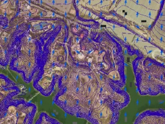
- Hydrogeological Flow Assessment
- Contaminant Distribution
- Geochemical Analysis
- Remediation Design and Optimization
- Stormwater and Spill Response Planning
- Contour Creation
- Hydraulic Flow Assessment
- Drainage Area Identification
- Best Management Practice Optimization
- Response Asset Planning
-
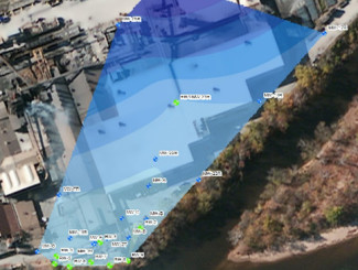
- Surface flow analysis for spill response planning
-
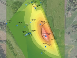
- Groundwater contaminant plume analysis
-
- Groundwater flow analysis